The Outcome
After reviewing the existing app, Square V visited with Apal customers to understand how their soil sampling was carried out and discovered that there were two different processes when it came to soil sampling - some people would plan all of their sampling in advance in the office or with the farmer prior to setting foot in the paddock, and others would turn up at the paddock and then do more on-the-fly sampling based on discussions with the farmer about the upcoming season.
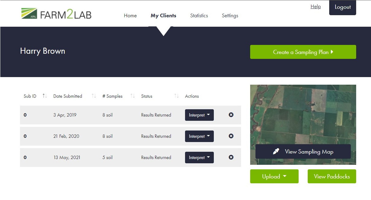
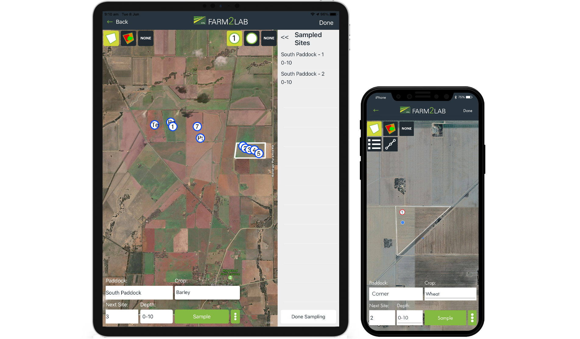
Based on these findings, we created a new process of "Guided Soil Sampling", allowing sampling plans to be created in the office and then downloaded to the sampler's tablet to be carried out in the paddock before being uploaded to the lab directly. The new app was designed to support this new process along with the existing "Unplanned Soil Sampling".
The app was rebuilt in Xamarin to be innately cross-platform, with a built-in "Offline Mode" allowing samples to be taken on the device and then stored in the device's memory until the sampler returned to phone signal. The app can also connect to external Bluetooth barcode scanners, speeding up the process for bulk sampling. Users of the new app have indicated that it has saved them many hours of work and added a much greater level of efficiency to their sampling process.
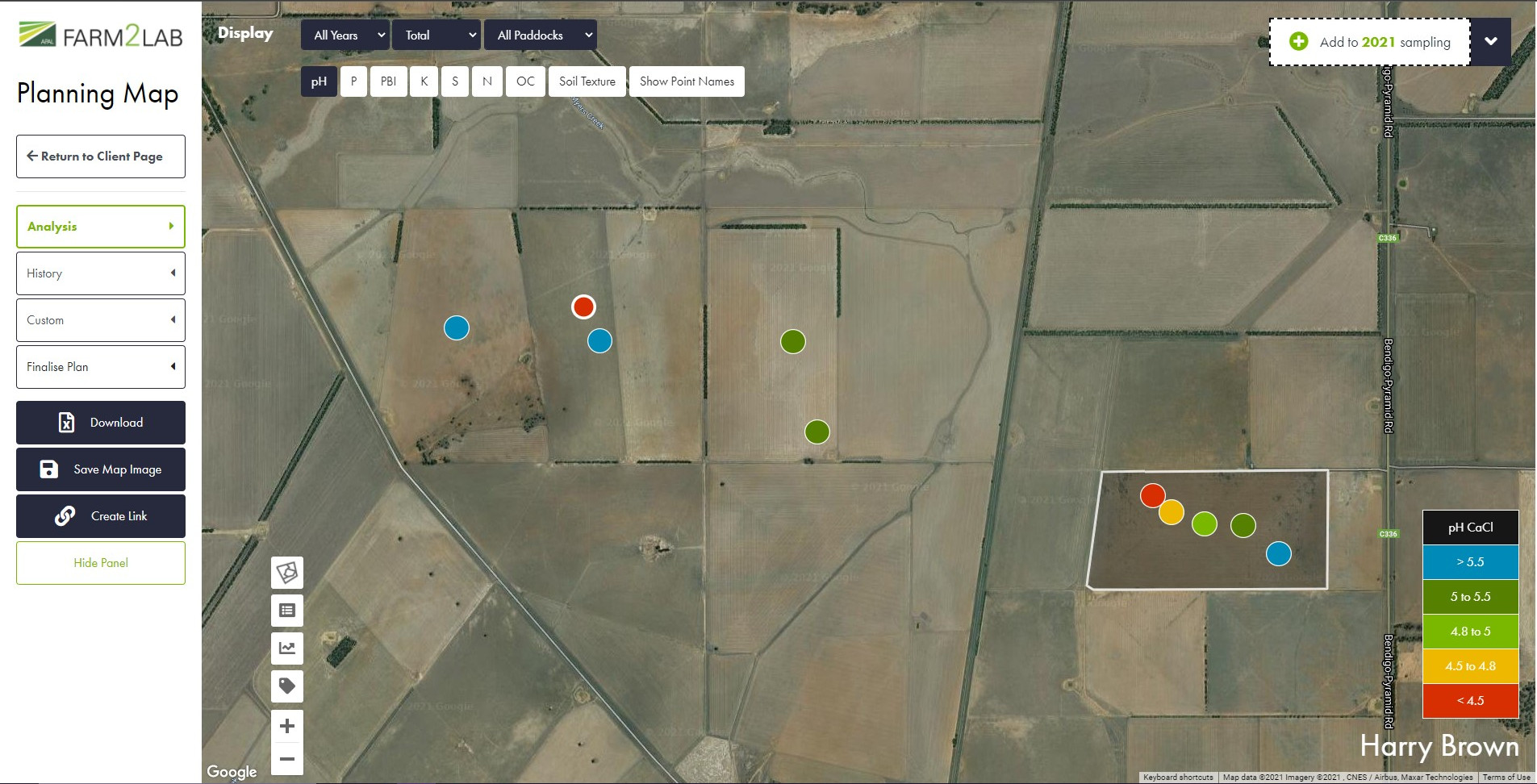
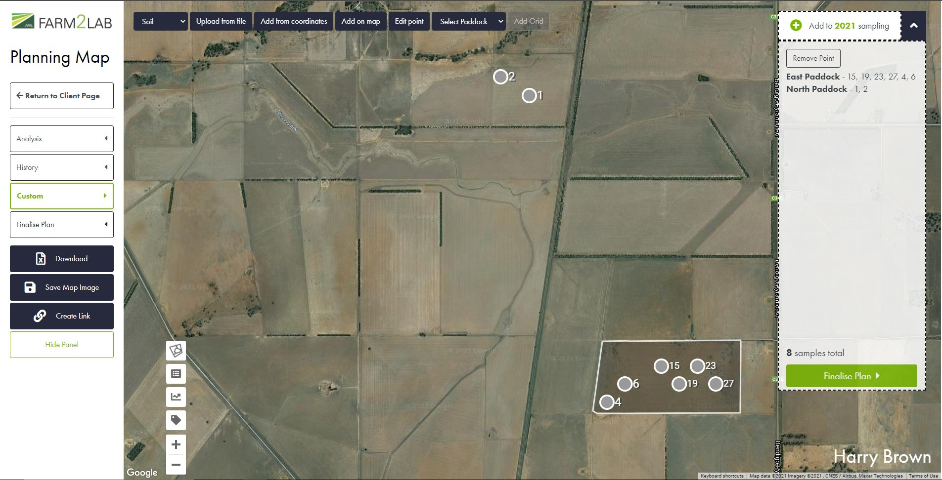
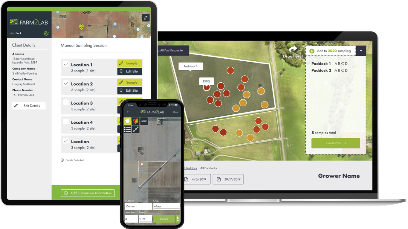
As well as the app, we built a web portal that allowed the creation of these Guided plans in the office, with sampling locations being added via a map or uploaded from other programs such as Google Earth, SST or Trimble. Once results are processed by the lab, the map then displays the colour-coded results back to the user, indicating based on element-specific ranges the status of the soil at each location. Allowing users to see their soil test results spatially alongside paddock boundaries and comparing against historical results is a game changer for the industry and provides a new level of power to Apal Farm2Lab users.
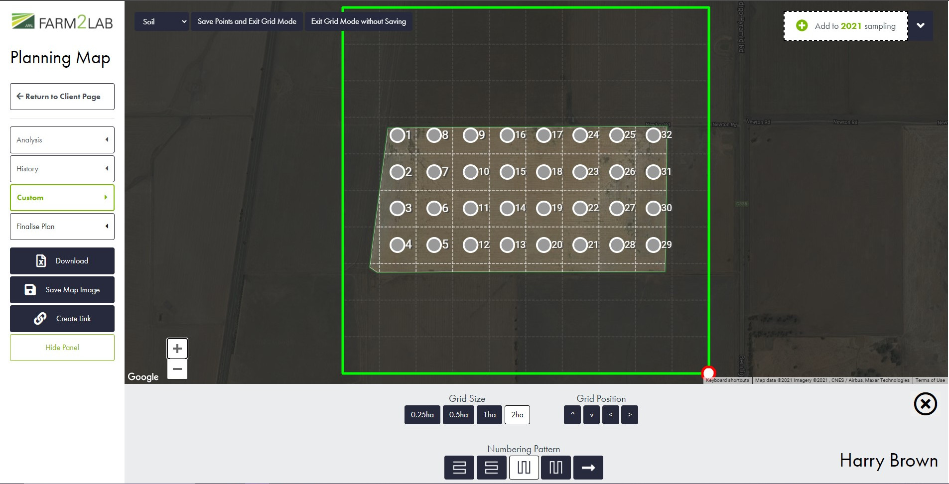
Over time the Farm2Lab system has been further developed to include plant sampling, paddock boundaries, transects and zonal sampling and grid sampling, with new functionality being added constantly based on user feedback to improve the product for the end users.
You can download the Farm2Lab app for iOS devices and for Android devices.